Source: Katrina 8-28-2005, National Oceanic and Atmospheric Administration
Source: Katrina 8-28-2005, National Oceanic and Atmospheric Administration
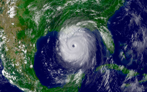
On August 28, 2005, Hurricane Katrina was in the Gulf of Mexico where it powered up to a Category 5 storm, packing winds estimated at 175 mph. On August 29, Hurricane Katrina made landfall in southern Plaquemines Parish Louisiana, just south of Buras, as a Category 3 hurricane. Maximum winds were estimated near 125 mph to the east of the center Katrina will be recorded as the most destructive storm in terms of economic losses.
Based on this information would this hurricane cause a voluntary or forced migration? Click on the term that matches your answer.
Interactive popup. Assistance may be required. Incorrect, the destruction and danger of Hurricane Katrina created a forced migration.
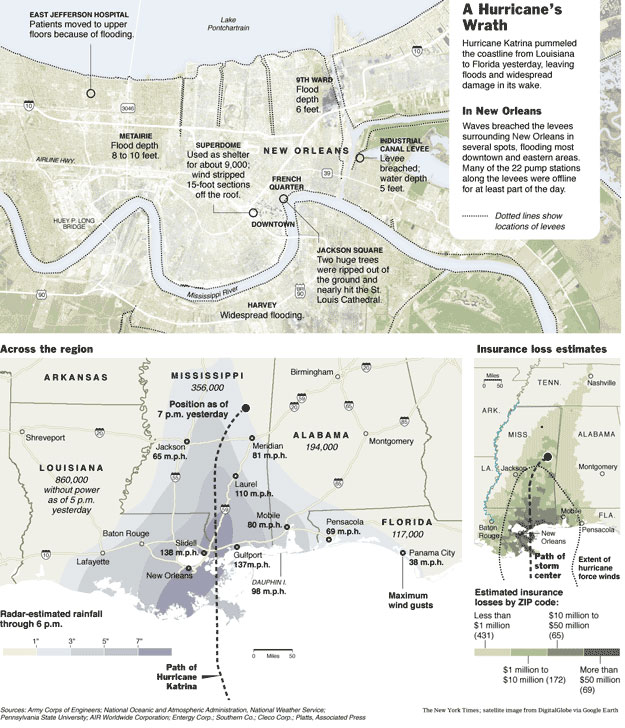
Source: Storm Graphic, New York Times
Click on the link below, Hurricane Katrina: The Storm's Impact, and take a look at the photos from the Hurricane Katrina Impact New Orleans series. Imagine that you are the subjects of one of the photos. In your notes, write a quick email to your best friend that describes what you experienced on August 29, 2005.
 Hurricane Katrina: The Storm's Impact
The map below of the United States was compiled by FEMA. It illustrates where Hurricane Katrina evacuees migrated to, based upon their applications for FEMA relief.
 Click on areas of the map below to get a closer look.
Activity:
FEMA was able to track the migrants of Hurricane Katrina from the zip codes of the applications for aid that were received. Below are the states from where the largest percentages of FEMA applications were received.