3-D image of the sun, NASA
Read the following background information about the sun to prepare you for the activities in this lesson:
3-D image of the sun, NASA
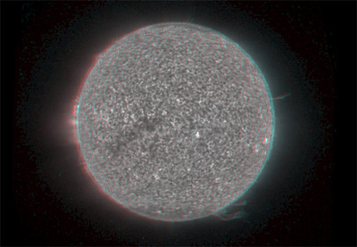
The image above is a 3-D image of the sun taken by NASA's STEREO satellite. It doesn't look like what you imagined the sun would look like.
Let's answer a few questions to see how much you know already about Earth and Sun relationships.
 Scroll over A and B to take a look at the climate in both regions and answer the question that follows.
Study the map and information below, and answer the question that follows.
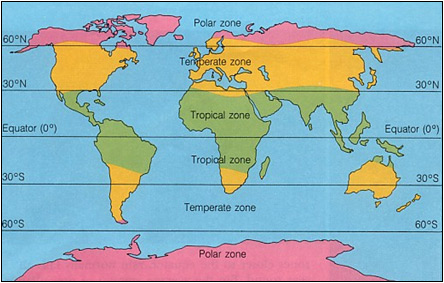
Climate Zones, Morris county USD 417
Polar Zone: The portion of the earth that forms a cap over the earth's poles. It is characterized by a frigid climate.
Temperate Zone: The portion of the earth's surface located between the Tropic of Cancer and the Arctic Circle in the Northern Hemisphere or between the Tropic of Capricorn and the Antarctic Circle in the Southern Hemisphere. It is characterized by having a climate that is warm in the summer, cold in the winter, and a moderate climate during the spring and fall.
Tropical Zone: The portion of the Earth's surface between the Tropic of Cancer and the Tropic of Capricorn. It is characterized by a hot climate.