In this section, we will be looking at continents, oceans, and other geographic features. Identifying and describing these features are important skills that every student of social studies must master. Physical geography, the study of the earth and its features, is an important part in all of the social studies courses you are required to take in middle school and high school.

CONTINENTS: Continents are landmasses, which vary in size and location. There are seven continents in all: Africa, Antarctica, Asia, Australia, Europe, North America, and South America. Most of the continents touch each other, with the exceptions being Antarctica and Australia.

  1. Africa:
    A special purpose map/globe featuring the continent of Africa

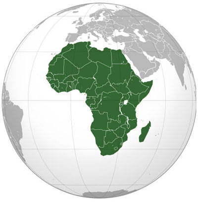
    Source: Africa (orthographic projection), Martin23230, Wikimedia

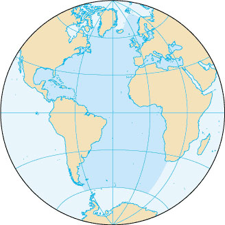
    Africa is the continent featured on this map and is the world's second largest and second most populous continent. It covers 11,730,000 square miles (30,370,000 square kilometers), and composes 20.4% of the Earth's total landmass. The total population of Africa is 922,011,000 (14% of the Earth's total population).

  2. Antarctica:
    A special purpose map/globe featuring the continent of Antarctica.

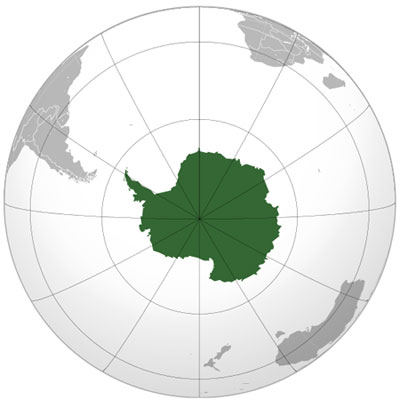
    Source: Antarctica (orthographic projection), Heraldry, Wikimedia

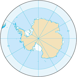
    Antarctica is the continent featured on this map. Antarctica is Earth's southernmost continent, encapsulating the South Pole. It is located in the Antarctic region of the Southern Hemisphere, almost entirely south of the Antarctic Circle. Antarctica covers 5,300,000 square miles (13,720,000 square kilometers) which is 9.2% of the Earth's total landmass. Despite its size, Antarctica is sparsely populated. Only several thousand people call Antarctica home, most of them seasonal.

  3. Asia:
    A special purpose map/globe featuring the continent of Asia

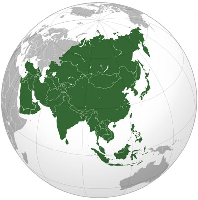
    Source: Asia (orthographic projection), Ssolbergj, Wikimedia

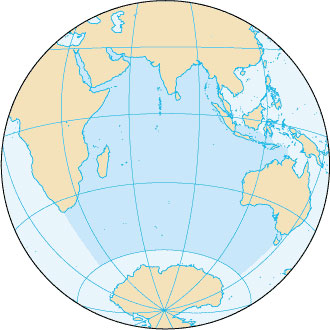
    Asia is the continent featured on this map. Asia covers 16,920,000 square miles (43,820,000 square kilometers). Asia is the world's largest and most populated continent covering 30% of the total landmass and is home to 3.88 billion people (60% of the Earth's entire population).

  4. Australia:
    A special purpose map/globe featuring the continent of Australia.

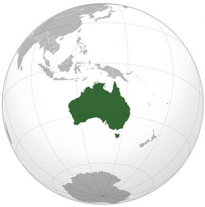
    Source: Australia (orthographic projection), Ssolbergj, Wikimedia

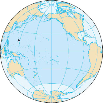
    Australia is the continent featured on this map. As you can see, Australia is an island. Australia covers 3,478,200 square miles (9,008,500 square kilometers) which is 5.9% of the Earth's total landmass. The smallest of the continents, Australia is home to 31,260,000 people.

  5. Europe:
    A special purpose map/globe featuring the continent of Europe.

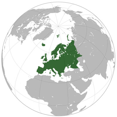
    Source: Europe orthographic Caucasus Urals boundary, Ssolbergj, Wikimedia

    Europe is the continent featured on the map above. Europe covers 3,930,000 square miles (10,180,000 square kilometers), or 6.8% of the total landmass. Even though Europe is small in comparison to other continents, it is densely populated (731,000,000 people).

  6. North America:
    A special purpose map/globe featuring the continent of North America.

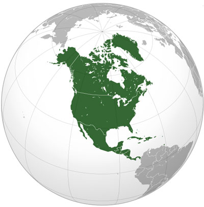
    Source: Location North America, Bosonic dressing, Wikimedia

    North America is the continent featured in the map above. North America covers 9,460,000 square miles (24,490,000 square kilometers) or 5.9% of the Earth's total landmass. The population of North America consists of 520,720,588 people (8% of the world's population).

  7. South America:
    A special purpose map/globe featuring the continent of North America.

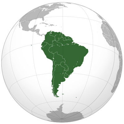
    Source: South America (orthographic projection), Luan, Wikimedia

    South America is the continent featured in the map above. South America covers 6,890,000 square miles (17,840,000 square kilometers), or 12% of the total landmass. The population of South America is 382,000,000 people (6% of the world's population).

Interactive exercise. Assistance may be required. Activity 1: Drag and the drop the continents in their proper location.

OCEANS:

  1. Atlantic Ocean:
    A special purpose map/globe showing the location and size of the Atlantic Ocean.

    Source: Atlantic Ocean, CIA World Factbook, Wikimedia

    Featured in the map above is the Atlantic Ocean. The Atlantic Ocean is the body of water that lies between the continents of North America, Europe, Africa, and South America.

  2. Pacific Ocean:
    A special purpose map/globe showing the location and size of the Pacific Ocean.

    Source: Pacific Ocean, CIA World Factbook, Wikimedia

    Featured in the map above is the Pacific Ocean. The Pacific Ocean lies between the continents of Asia, North America, South America, and Australia.

  3. Indian Ocean:
    A special purpose map/globe showing the location and size of the Indian Ocean.

    Source: Indianocean, CIA World Factbook, Wikimedia

    Featured in the map above is the Indian Ocean. The Indian Ocean lies between the continents of Africa, Asia, and Australia.

  4. Southern Ocean:
    A special purpose map/globe showing the location and size of the Indian Ocean.

    Source: Southern Ocean, CIA World Factbook, Wikimedia

    The map above features the Southern Ocean. The Southern Ocean covers the southern portion of the globe surrounding Antarctica.

  5. Arctic Ocean:
    A special purpose map/globe showing the location and size of the Artic Ocean.

    Source: Artic Ocean, CIA World Factbook, Wikimedia

    Featured in the map above is the Arctic Ocean. The Arctic Ocean covers the northern portion of the globe between the continents of North America, Europe, and Asia.

Interactive exercise. Assistance may be required. Activity 2: Drag and drop the correct names of the oceans on to the correct locations on the map.